SparkFun
SparkFun GNSS Flex pHAT - LG290P - SparkFun Electronics
· MPN: GPS-28929
Achieve robust, centimetre-level RTK positioning in challenging RF environments with the SparkFun LG290P GNSS Flex pHAT. This all-in-one development board co...
Achieve robust, centimetre-level RTK positioning in challenging RF environments with the SparkFun LG290P GNSS Flex pHAT. This all-in-one development board combines a versatile pHAT carrier with the powerful Quectel LG290P module, featuring advanced anti-jamming technology ideal for navigation in urban canyons, industrial sites, or any location where signal integrity is critical.
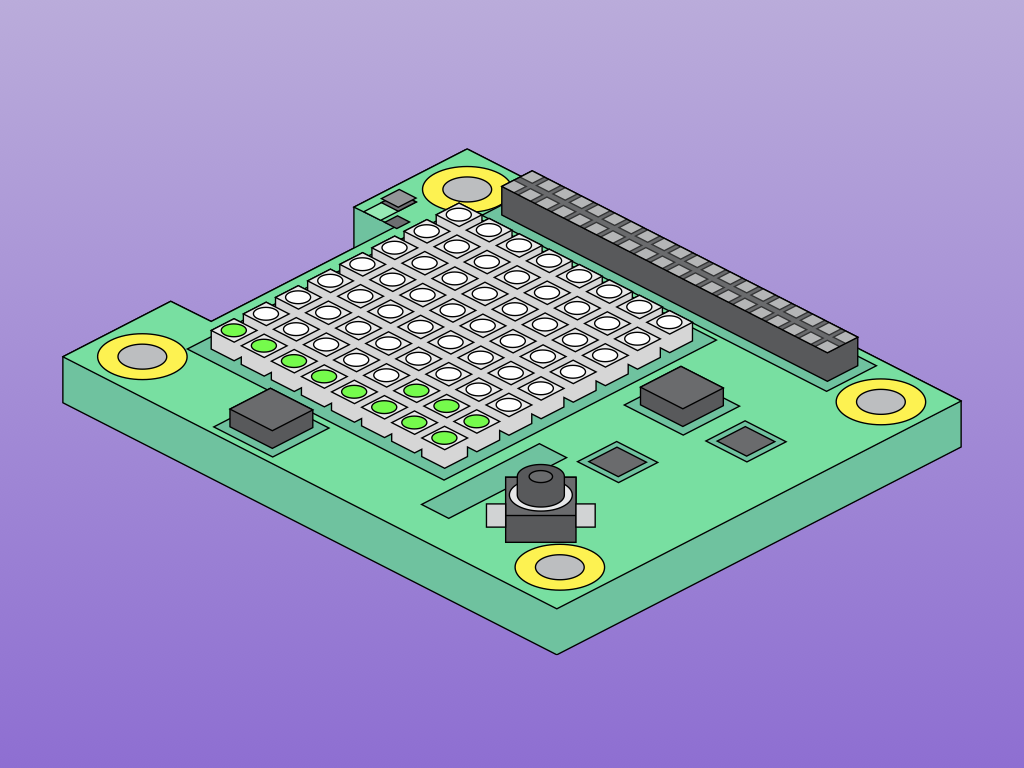
The GNSS Flex pHAT mounts to a Raspberry Pi via an extended 40-pin header and connects to the included GNSS module using standardised 2×10-pin headers, making it simple to swap modules for future upgrades. All necessary standoffs, screws, and an extended header are included.
Key Features
- Centimetre-Level RTK – 0.8 cm + 1 ppm horizontal accuracy with 5-second convergence time
- Quad-Band Multi-Constellation – Receives L1, L2, L5, and L6/E6 bands across GPS, GLONASS, Galileo, BDS, QZSS, and NavIC
- Advanced Anti-Jamming – Built-in NIC anti-jamming unit for professional-grade interference mitigation
- 1,040 Tracking Channels – Robust performance even in urban canyons or deep tree cover
- Raspberry Pi Compatible – Standard 40-pin GPIO header with USB-C alternative data interface
- Modular Design – SparkPNT GNSS Flex system allows swapping modules for future upgrades
- Qwiic Connector – For easy I²C expansion
- µSD Card Socket – For data logging
GNSS Flex pHAT Specifications
- Raspberry Pi Interface: 40-pin GPIO socket
- Module Interface: Two 2×20-pin, 2 mm pitch male headers (UART ×4, I²C, USB, SD, PPS ×2)
- USB-C Port: Direct interface to GNSS Flex module
- Antenna: U.FL connector with SMA bridge option
- Indicator LEDs: PWR (red), PPS (yellow), RTK (white), PVT (blue)
- Jumpers: 24 total — GPIO isolation (×16), LED power isolation (×4), I²C pull-ups (×4)
LG290P Module Specifications
- Supply Voltage: 3.15–3.45 V
- Current Consumption: 91 mA typical (acquisition/tracking), 12 µA backup mode
- Horizontal Accuracy: 0.7 m autonomous, 0.8 cm + 1 ppm RTK
- Vertical Accuracy: 2.5 m autonomous, 1.5 cm + 1 ppm RTK
- Velocity Accuracy: 0.03 m/s
- 1PPS Accuracy: 5 ns (RMS)
- Update Rate: 10 Hz default, 20 Hz max
- TTFF (Cold Start): 28 s
- TTFF (Hot Start): 1.7 s
- Sensitivity: -146 dBm acquisition, -160 dBm tracking
- Dynamic Limits: 10,000 m altitude, 490 m/s velocity, 4 g acceleration
- UART: 3× ports, 9,600–3,000,000 bps (default 460,800 bps), NMEA 0183/RTCM 3.x
- Operating Temperature: -40°C to +85°C
- Module Size: 12.2 × 16 × 2.6 mm
- Module Weight: ~0.9 g
Supported Constellations & Frequency Bands
- GPS: L1 C/A, L1C*, L5, L2C
- GLONASS: L1, L2
- Galileo: E1, E5a, E5b, E6
- BDS: B1I, B1C, B2a, B2b, B2I, B3I
- QZSS: L1 C/A, L1C*, L5, L2C
- NavIC: L5
- SBAS: L1 C/A (WAAS, SDCM, EGNOS, BDSBAS, MSAS, GAGAN)
* Feature still under development
Ideal For
- High-precision RTK surveying and mapping
- Autonomous vehicle and drone navigation
- Precision agriculture
- Base station and rover configurations
- GNSS research and development
Package Contents
- 1× SparkFun GNSS Flex pHAT
- 1× SparkPNT GNSS Flex Module (LG290P)
- 1× Tall GPIO Female Headers (2×20 pin)
- 1× 50 mm U.FL to U.FL Cable
- 4× Aluminium Hex Standoffs (M2.5, 16 mm)
- 8× Phillips Machine Screws (M2.5 × 8 mm)
Resources
- Hookup Guide
- LG290P Product Brochure (PDF)
- RTK Application Note (PDF)
- Base Station Mode Application Note (PDF)
- Protocol Specification (PDF)
- Hardware Design (PDF)
- Firmware Upgrade Guide (PDF)
- QGNSS Software (v2.x)
Design Files — GNSS Flex pHAT
Design Files — LG290P Flex Module
GitHub Repositories
Jargon buster
Plain-language definitions for the technical terms used above.
- 1PPS
- One Pulse Per Second is a precise timing signal often provided by a satellite positioning receiver. It matters when a project needs very accurate time alignment, such as timestamping logged data.
- Active GNSS antenna
- An active GNSS antenna has a built-in amplifier that needs power from the board. It can improve satellite signal reception, but you need to use an antenna that matches the board’s powered antenna connection.
- B1I
- A BeiDou satellite signal used for standard positioning. It matters because the receiver must support the signal bands used by a constellation to take advantage of those satellites.
- B2a
- A BeiDou satellite signal used by newer dual-band GNSS receivers. Support for B2a can improve accuracy and reliability when combined with other GNSS bands.
- BDS
- BeiDou, China’s satellite navigation system. Support for BDS gives the receiver access to more satellites, which can help maintain a better position fix in challenging locations.
- E1
- A Galileo satellite signal band used for standard positioning. Knowing which signal bands are supported helps you judge compatibility and expected performance of a GNSS receiver.
- E5a
- A Galileo satellite signal band used for higher-performance positioning services. Support for E5a can help dual-band GNSS receivers improve accuracy and reduce errors from atmospheric delay.
- EGNOS
- Europe’s SBAS service for improving GNSS positioning accuracy and reliability. It is relevant if the receiver will be used in Europe or nearby supported areas without an RTK correction link.
- GAGAN
- India’s SBAS service for improving GNSS positioning. It matters for projects in its coverage region because it can improve standard GNSS accuracy when RTK is not being used.
- Galileo
- Europe’s satellite navigation system. Galileo support can improve satellite availability and accuracy, especially when combined with GPS and other constellations.
- GLONASS
- Russia’s satellite navigation system. A receiver that can also use GLONASS has more satellites to choose from, which can improve positioning reliability when the sky view is partly blocked.
- GNSS
- GNSS stands for Global Navigation Satellite System, covering positioning systems such as GPS and similar satellite networks. It matters here because high-precision GNSS modules can output lots of serial position data that this product can send wirelessly to a computer or phone.
- GPIO
- General-purpose input/output pins are microcontroller pins you can set in software to read signals, switch devices on and off, or connect to peripherals. The number of GPIO pins matters because it limits how many buttons, LEDs, sensors, and other parts you can wire directly to the board.
- GPS
- The US satellite navigation system used by GNSS receivers to calculate position and time. Support for GPS is important because it is widely available and often used together with other constellations for more reliable positioning.
- Headers
- Rows of metal pins used to plug a module into a breadboard or connect it with jumper wires. Pre-soldered headers make the module easier to use straight away without needing to solder the pins yourself.
- L2C
- A second GPS signal band used by dual-band GNSS receivers to improve precision and reduce errors caused by the atmosphere. It matters for RTK and high-accuracy applications because using two bands can produce faster and more reliable centimetre-level fixes.
- L5
- A modern GNSS signal band used by several satellite systems for more accurate and robust positioning. Dual-band receivers that include L5 can often perform better than single-band receivers, especially for RTK and areas with reflected signals.
- LED
- A light-emitting diode is a small electronic component that lights up when current flows through it in the correct direction. In this kit, LEDs create the flashing effect, so polarity and correct soldering matter for the project to work.
- M2.5
- A metric screw thread size with a 2.5 mm nominal diameter. It matters for mounting because screws, standoffs, and holes must use the same size to fit securely without damaging the board.
- MSAS
- Japan’s SBAS service for improving GNSS positioning. It is useful to know because SBAS benefits depend on whether your project is located in the service’s coverage area.
- NMEA 0183
- A standard text-based data format used by GPS and GNSS receivers to send position, time and satellite information. If your microcontroller or software can read NMEA 0183, it can usually parse basic location data from this kit.
- pHAT
- A smaller add-on board format for Raspberry Pi, similar in idea to a HAT but usually not full-sized. It matters because pHAT compatibility can affect how neatly a board stacks or fits into a Raspberry Pi project.
- ppm
- ppm means parts per million, a common way to express very small gas concentrations in air. For CO₂ sensors, the ppm range tells you what levels the sensor can measure, such as normal indoor air through to poorly ventilated spaces.
- PVT
- Position, velocity and time data reported by a GNSS receiver. Knowing the PVT update rate helps you judge how often the board can provide basic navigation information to your project.
- Qwiic
- Qwiic is a plug-in connector system for I2C devices that uses small 4-pin cables, so you can connect compatible sensors without soldering. It matters because your controller or adapter also needs Qwiic, or you will need a cable or breakout to wire it up.
- QZSS
- Japan’s regional satellite navigation system designed to improve coverage around Japan and the Asia-Pacific region. QZSS support can improve satellite availability in supported regions when used alongside GPS.
- RF
- RF means radio frequency, referring to signals used for wireless communication and other high-frequency electronics. A low-noise, stable power supply is important for RF circuits because power noise can affect signal quality and measurements.
- RMS
- RMS is a way of describing the effective level of an AC signal, such as an audio output voltage. It helps compare audio output levels more meaningfully than a peak voltage number.
- RTCM 3.x
- RTCM 3.x is a standard data format used to send GNSS correction information from a base station to a rover. It matters because both ends of an RTK setup need to understand the correction format to achieve high-accuracy positioning.
- RTK
- Real-Time Kinematic positioning is a GNSS technique that uses correction data from a base station to greatly improve location accuracy. It matters if you need centimetre-level positioning for robotics, mapping, surveying, or tracking rather than ordinary metre-level GPS accuracy.
- SBAS
- Satellite-Based Augmentation System, a set of regional services that broadcast correction information for GNSS receivers. SBAS can improve ordinary GPS-style positioning, although it is not the same as centimetre-level RTK correction.
- single-board computer
- A complete computer built onto one circuit board, usually including the processor, memory, ports, and connectors. This matters because accessories like heatsinks must match the board’s layout and mounting holes to fit properly.
- SMA
- A threaded coaxial connector commonly used for antennas. It matters because you need antennas with matching SMA connectors, or suitable adapters, for the LTE and GNSS antenna ports.
- u.FL
- u.FL is a tiny snap-on antenna connector often used on compact wireless boards. A board with u.FL usually needs an external antenna, which matters if the product will be inside an enclosure or needs better antenna placement.
- UART
- UART is a simple serial connection that sends data over separate transmit and receive wires, often labelled TX and RX. It matters because this module is designed to replace a wired UART cable with a wireless link while keeping the same serial data format.
- UPS
- An uninterruptible power supply is a battery-backed power system that keeps a device running when external power is unplugged or fails. For an embedded computer, it helps prevent sudden shutdowns that can corrupt files or interrupt a project.
- USB-C
- A modern reversible USB connector used for power and data connections. On this product it matters because it can connect directly to a computer as well as to a microcontroller project.
- WAAS
- A North American SBAS service that provides correction data for GNSS receivers. It matters if you are using the product in a supported region and want better non-RTK positioning accuracy.
Find this product in
Brands
Raspberry Pi
Sensors & Input
GNSS Flex pHAT Schematic
Schematic · 124.0 KB · Click any page to view full size
GNSS Flex pHAT Board Dimensions
Mechanical Drawings · 236.3 KB · Click any page to view full size
Quectel LG290P Module Specification
Datasheet · 195.2 KB · Click any page to view full size
LG290P RTK Application Note
App / Software · 1.7 MB · Click any page to view full size
LG290P Base Station Mode Application Note
App / Software · 1.2 MB · Click any page to view full size
LG290P GNSS Protocol Specification
Datasheet · 736.3 KB · Click any page to view full size
LG290P Hardware Design Guide
User Guide · 1.4 MB · Click any page to view full size
LG290P Firmware Upgrade Guide
User Guide · 519.2 KB · Click any page to view full size
Supplier page — sparkfun.com
Supplier Description · 1.1 MB · Click any page to view full size
Resources & Downloads
Guides, code examples, and more
Related Tutorials
Free guides on learn.littlebird.com.au